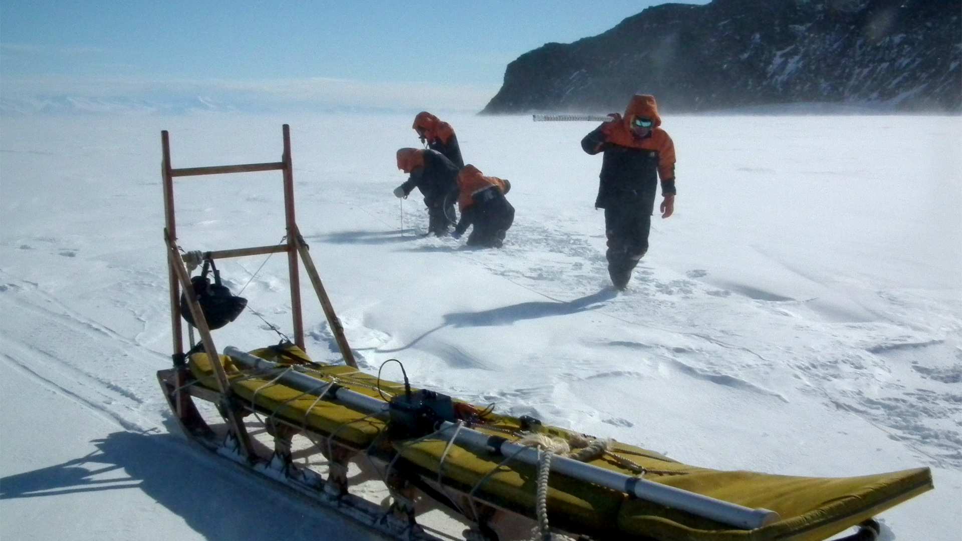


Photo caption: : Field researchers conducting sea ice observations in Antarctica - Photo credit: Wolfgang Rack
Key points
- UC researchers use satellite data and advanced remote sensing technologies to measure changes in Antarctic sea ice, glaciers, and ice sheets.
- The research improves understanding of how Antarctica is responding to climate change and how those changes may influence global weather, ocean circulation, and sea levels.
- Data collected in Antarctica improves global environmental models, supports international climate research, and aids climate adaptation planning.
Measuring Antarctic sea ice
Antarctic sea ice plays a critical role in the Earth's climate system. It helps regulate global temperatures by reflecting solar radiation and it influences oceanic and atmospheric circulation patterns that affect weather around the world.
Research led by Professor Wolfgang Rack from Gateway Antarctica at the University of Canterbury (UC) investigates one of the most important challenges in polar science: accurately measuring Antarctic sea-ice thickness.
While satellites can measure the extent of sea ice relatively easily, determining its thickness remains much more difficult. UC researchers use a combination of satellite observations and airborne electromagnetic measurements to improve estimates of sea-ice thickness and better understand changes occurring across the Southern Ocean.
Tracking glaciers and ice-sheet change
The research also examines the movement of glaciers flowing through the Transantarctic Mountains and into the Antarctic ice sheets.
Using high-resolution satellite imagery, radar interferometry (InSAR), and feature-tracking techniques, researchers measure ice flow, ice thickness, and surface elevation. These observations help scientists understand how Antarctic ice sheets are responding to a warming climate and improve models used to predict future ice-sheet behaviour.
Understanding these processes is essential because changes in Antarctic ice loss could have significant implications for global sea-level rise over coming decades and centuries.
Mapping snow accumulation from space
A further focus of the research is measuring snow accumulation across Antarctica and Greenland.
Snowfall is a key contributor to ice-sheet growth and understanding how much snow accumulates helps determine whether an ice sheet is gaining or losing mass overall. Using satellite remote sensing, researchers map snow accumulation across vast polar regions that are otherwise extremely difficult to monitor.
Informing climate science and decision-making
By combining satellite observations, field measurements, and advanced geospatial analysis of both ice and snow, UC researchers are helping answer some of the most important questions in climate science.
The research contributes to international efforts to understand how Antarctica is changing and what those changes may mean for future climate, ocean circulation, and sea-level rise. The resulting data supports scientific modelling, environmental policy, and long-term climate adaptation planning.
Antarctica plays a fundamental role in the Earth's climate system. Understanding how sea ice, glaciers, and ice sheets are changing is essential for predicting future environmental change and its impacts around the world.– Professor Wolfgang Rack
Talk to Professor Wolfgang Rack about Antarctic remote sensing, sea ice, glaciers, ice-sheet dynamics, and polar climate research.
Last updated: October 2026
Related topics
Signature Capabilities
Sustainable Development Goals (SDGs)

Contact

We gratefully acknowledge funding from the Marsden funding, European Horizon Pillar II (Synchrony), Antarctic Science Platform and a number of smaller catalyst funds.
Read other showcases
Take a look at our showcases to see UC’s research expertise in practice.