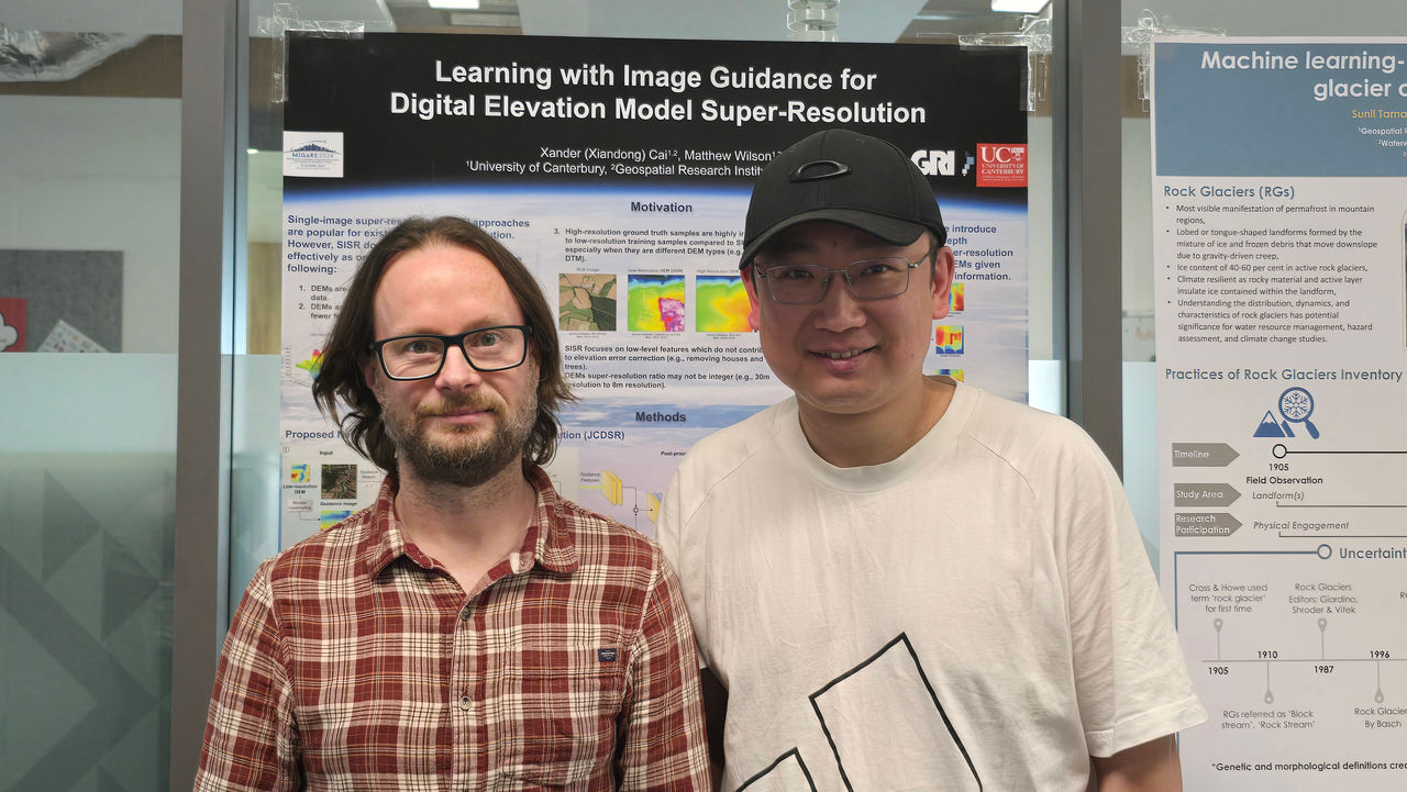


Photo caption: Researchers from the University of Canterbury’s Geospatial Research Institute, Professor Matthew Wilson and Xiandong Cai, are using AI to democratise access to accurate elevation data.
Researchers Xiandong Cai and Professor Matthew Wilson from Te Whare Wānanga o Waitaha | University of Canterbury’s (UC) Toi Hangarau | Geospatial Research Institute have developed a deep-learning model called Joint Spatial Propagation Super-Resolution (JSPSR) that uses AI to dramatically enhance global satellite elevation data.
Professor Wilson says the team’s goal is to democratise access to accurate elevation data. “AI allows us to achieve high accuracy and good spatial resolution using open satellite data that is accessible to everyone.”
High-quality elevation data is essential for planning everything from flood modelling to infrastructure design, agriculture and renewable-energy development. Currently, the most accurate option is Light Detection and Ranging (LiDAR), which provides exceptional detail, but for many nations it is too expensive and logistically demanding, requiring specialised aircraft, equipment and technical capability.
Governments across much of Africa, Asia and the Pacific currently rely on basic global satellite elevation datasets that lack the fine-scale detail needed for reliable modelling of landscapes and waterways.
Addressing this gap, JSPSR uses AI to generate high-resolution, bare-earth digital elevation models (DEMs) using only open satellite data and modest computing power.
Early results show that the JSPSR model can deliver a ten-fold improvement in spatial resolution, and around a 72% improvement in elevation accuracy, compared to the basic datasets. In addition, JSPSR delivers 1.05 m Root Mean Square Error (RMSE), vertical accuracy from 30 m input data, and up to four times faster processing than the widely used Enhanced Deep Residual Networks for Single Image Super-Resolution (EDSR) method.
Cai says, “while the new technology is not a replacement for LiDAR, JSPSR provides far more accurate elevation information than current free satellite datasets at a fraction of the cost of LiDAR. This could transform flood-risk mapping and environmental planning for districts or countries that currently lack the resources to capture LiDAR data. Our ongoing work aims to further refine and validate the model so it can be applied reliably across global landscapes.”
Potential applications include:
Infrastructure and Urban Planning: Flood-risk assessment, stormwater design, transport planning.
Agriculture and Land Management: Irrigation modelling, erosion monitoring, precision agriculture.
Environmental Monitoring and Climate Resilience: Sea-level rise modelling, habitat mapping, carbon-stock estimation.
Energy and Renewable Development: Hydrological modelling, hydro site design, renewable generation planning.
The research exemplifies the goals of the AI for Good movement, led by the International Telecommunication Union, which encourages the use of AI to advance the United Nations Sustainable Development Goals.
Professor Wilson says, “by making high-quality terrain data affordable and accessible, the UC team’s work supports global efforts to strengthen climate resilience, reduce inequalities and enable sustainable infrastructure development in regions that need it most.”
The project is part of UC’s expanding AI and geospatial research portfolio, which brings together experts across engineering, environmental science and computer science to solve some of the most pressing problems facing by humanity. Together, these teams are demonstrating how advanced AI methods can be applied for global benefit, turning complex data science into powerful tools for sustainable development.


,%20Jake%20Campbell%20(CTO%20and%20co-founder),%20Jamie%20Cairns%20(CEO%20and%20co-founder)%20lowres.jpg)