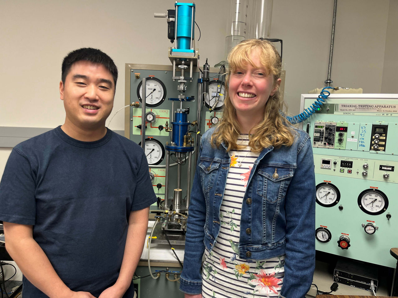


Photo caption: Dr Robin Lee and Dr Camilla Penney from the University of Canterbury have been awarded Natural Hazards Commission grants towards their innovative research projects.
Dr Camilla Penney, a lecturer in Te Whare Wānanga o Waitaha | University of Canterbury (UC) School of Earth and Environment, and Dr Robin Lee, from the UC Department of Civil and Environmental Engineering, have been awarded 2026 funding from the Natural Hazards Commission (NHC) Toka Tū Ake Biennial Grants programme towards their innovative seismic risk projects.
Dr Penney and Dr Lee’s research aims to harness technology to improve understanding of where future earthquakes could happen and assess the hazard they pose for people and buildings.
Dr Penney has received a $100,000 biennial grant towards developing new statistical methods to connect real earthquake records with long-term computer simulations, with the goal of making the computer models more reliable. The results will enable the first trial forecasts to show where and when future earthquakes might occur in New Zealand, supporting more accurate seismic hazard assessments in the future.
“At the moment we have data from real earthquakes that have occurred in New Zealand over the last 150 years and we have computer simulations based on our known earthquake faults for the last 500,000 years, but we don’t have a method to compare the two of them,” Dr Penney says.
“We want to rigorously test these computer simulations to ensure they’re accurate before we use them for seismic hazard assessment.”
However, she says there will always be limitations on the models’ earthquake forecasting power.
“Most of the damaging earthquakes that have happened in New Zealand have not been the ones we expected because they’ve been on faultlines that we didn’t know about before. We think there are still a lot of those around. These models can’t include the things we don’t already know about, so it’s almost certain that whatever we come up with won’t be what actually happens.
“But they can tell us something about how complicated earthquakes might be. The Kaikōura earthquake was complex because it did things we wouldn’t normally expect. Over 20 different faults moved in that earthquake.
“The models can help us find out whether that happens very often, and what happens to the faults nearby in that scenario, so in those senses they are a useful forecasting tool.”
Dr Penney says another gap in our knowledge is that the historical record of New Zealand’s earthquakes is relatively short. “Seismometer readings only began about 70 years ago, written records 180 years ago, and there has been very little work on Māori oral histories of earthquakes and how to make responsible use of them.”
Dr Lee has received $75,000 from NHC to create updated high-resolution maps of ground conditions across New Zealand that will help identify areas where local soil or rock conditions could make earthquake shaking stronger and more likely to cause damage.
His project will combine modern statistical and machine learning methods with around 20,000 geotechnical test results from the New Zealand Geotechnical Database (NZGD). These tests, commonly carried out during construction site investigations, measure how strong and stiff the ground is. Dr Lee’s team will use this information to significantly improve and refine New Zealand’s existing map of Vs30, a key measure of ground conditions up to 30 metres depth.
“Creating a more comprehensive, detailed and accurate map of ground conditions across Aotearoa New Zealand will help us identify areas that are more likely to be at risk of damage in an earthquake,” Dr Lee says.
“It’s not just whether the ground is rock or soil,” Dr Lee says. “The type of soil, how dense it is, and how thick the soil layers are, can greatly influence how strongly the ground shakes in a quake.”
The existing Vs30 map uses data from fewer than 400 sites, mainly around Canterbury, with the rest of the country based on limited data and broad estimates.
The updated Vs30 maps will be released as open datasets for use by various stakeholders, including researchers, engineers, planners and government agencies.
Two other UC researchers also received NHC Toka Tū Ake funding for quake-related research projects; Professor Santiago Pujol and Professor Rajesh Dhakal.

,%20Jake%20Campbell%20(CTO%20and%20co-founder),%20Jamie%20Cairns%20(CEO%20and%20co-founder)%20lowres.jpg)