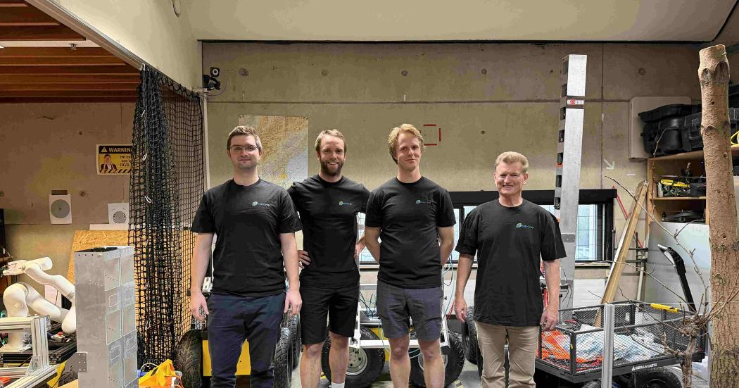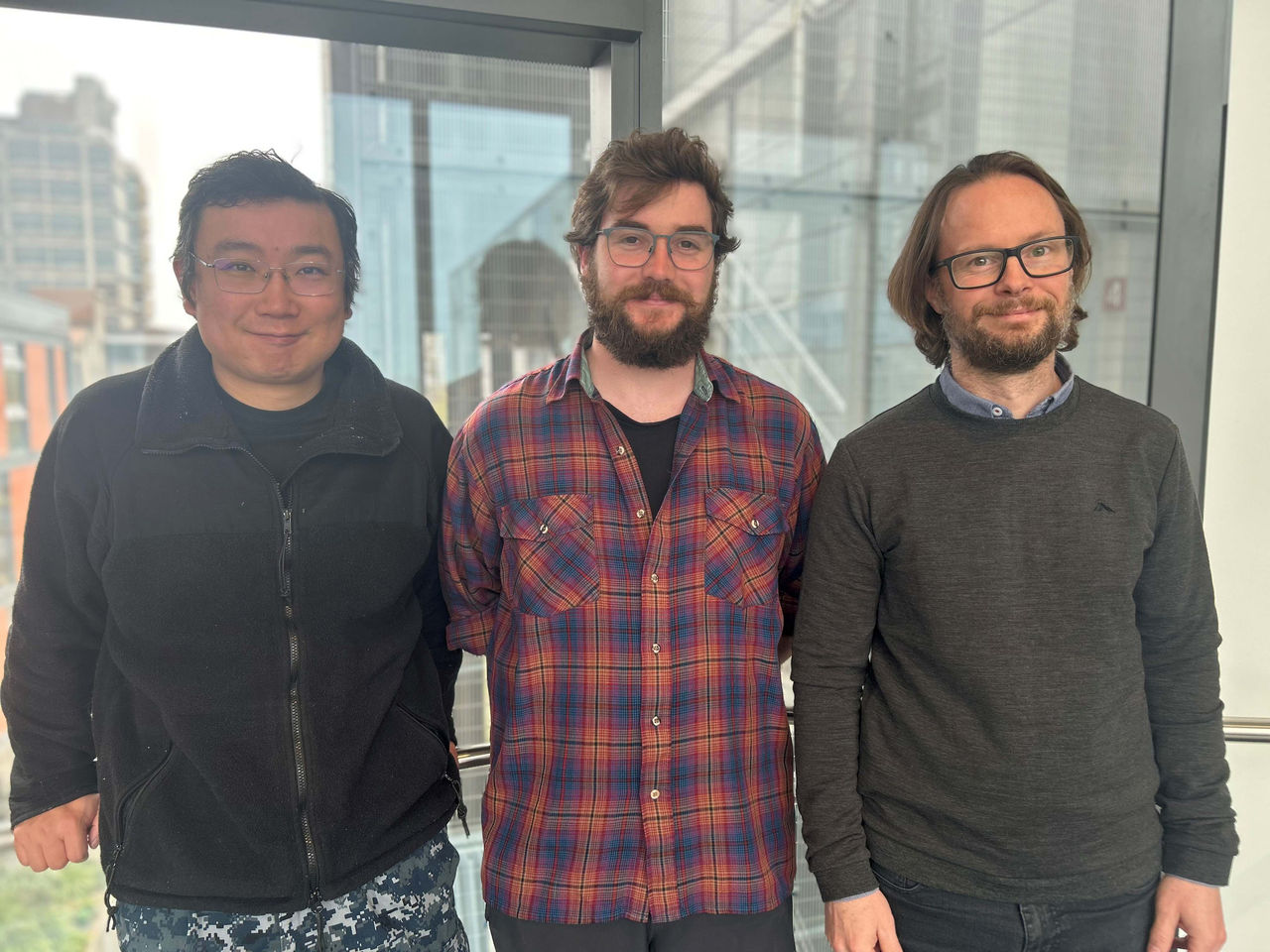


Photo caption: UC Xander Cai, Luke Parkinson and Professor Matthew Wilson developed the VR tool to understand flood risks
Professor Matthew Wilson, Director of the Geospatial Research Institute at Te Whare Wānanga o Waitaha | University of Canterbury (UC), is leading the research team including Luke Parkinson (UC), Iain Grover (Te Rūnanga o Ngāi Tahu) and Xander Cai (UC), that is developing high resolution, dynamic visualisations of flood impacts under various scenarios. By transforming complex flood modelling into realistic, interactive visualisations, the tool makes risks easier to grasp and gives communities and decision-makers the insights they need to plan for change.
Professor Wilson says floods are intensified by a combination of heavier rainfall and rising sea levels, that increase the impact on low-lying areas, especially when they occur together. The loss of natural vegetation, for example through urbanisation, also aggravates flooding by speeding up how quickly water flows through catchments and magnifying its impact in communities.
“What we are doing is taking scenarios of flooding produced using hydraulic modelling and developing the technology to visualise them within virtual reality,” says Professor Wilson.
“If we represent potential community flooding in a more visually engaging, realistic way, we can help people to understand their flood hazards.”
Professor Wilson says a so-called ‘1-in-100-year flood’ doesn’t mean once in a century – it means there’s roughly a 26% chance of flooding over the 30-year life of a typical home mortgage. Some parts of New Zealand may face increasing challenges in remaining safely inhabited due to rising flood risks, which will require thoughtful, long-term planning and decision-making at both community and national levels.
While the VR tool can visualise flooding events in communities, it can also be used to show how interventions could reduce the severity of the flood.
“We can look at the outcomes of interventions at the catchment level using natural flood solutions such as wetland or native forest restoration.”
He says the tool could be used to compare flood scenarios before and after implementing interventions, showing how those can slow water flow and reduce flood severity.
“By visually comparing these outcomes, communities and decision-makers can better understand the tangible benefits of investing in natural flood solutions.
“My hope is that we will be able to take flood model outputs and automate our visualisation process, for any community in the country.”
This project is supported by the Natural Hazards Commission, with future development funded through MBIE’s Smart Ideas programme. It has been developed in partnership with Te Rūnanga o Ngāi Tahu’s geospatial and transformation teams, and the Ngāi Tahu Research Centre at the University of Canterbury.
 Impact Rankings")
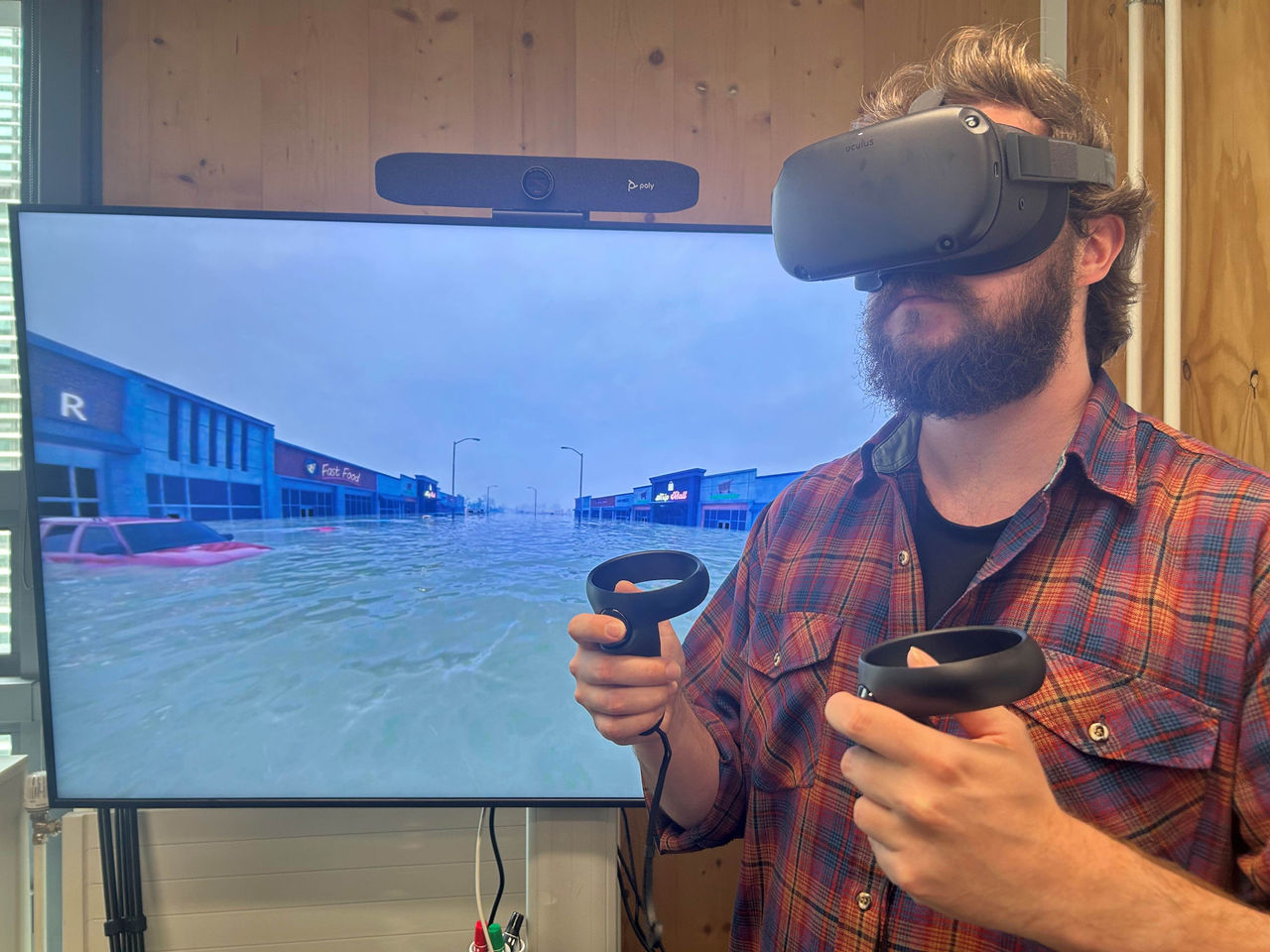
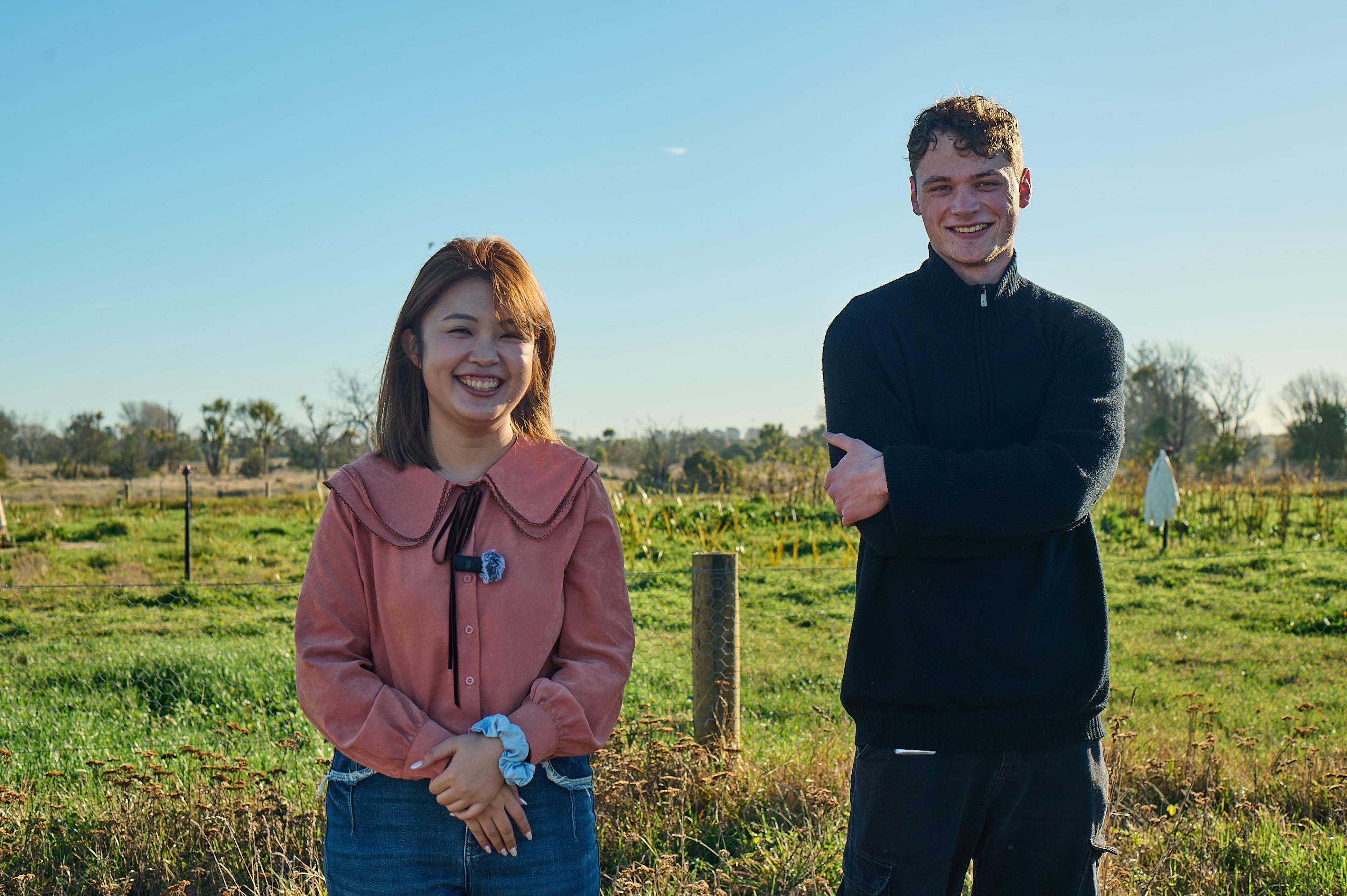
Photo caption: Luke Parkinson demonstrates the VR tool, letting users step inside future flood scenarios to better understand the risks.