Petone’s vulnerable coastal setting offers valuable lessons for how Aotearoa New Zealand can make its infrastructure more resilient to climate change.
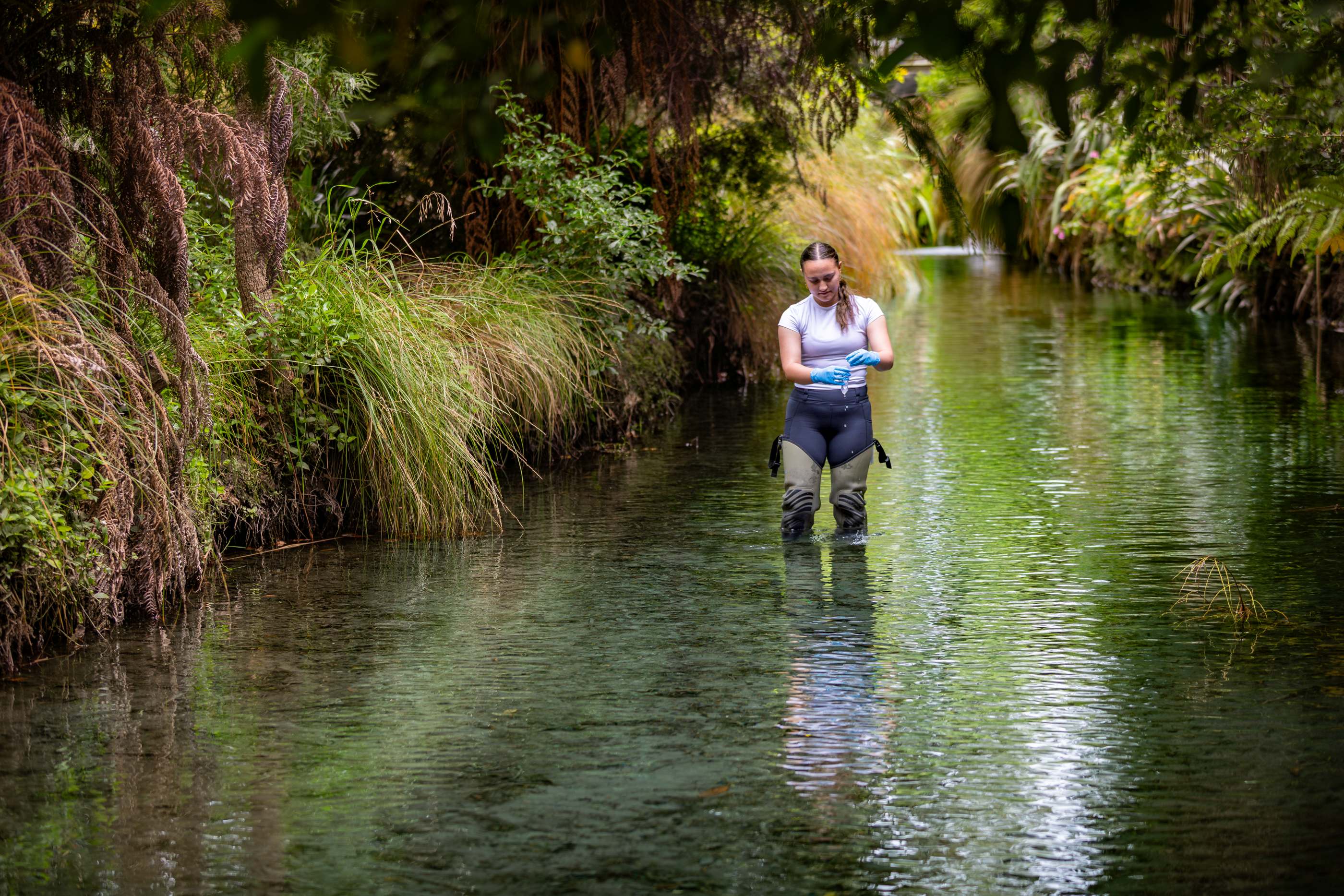
Te Whare Wānanga o Waitaha | University of Canterbury (UC) Master of Science student Lucy Dunshea is investigating how nature-based solutions such as rain gardens, constructed wetlands and permeable surfaces could help reduce flood risk while supporting biodiversity, protecting infrastructure and improving community wellbeing.
“I grew up in Wellington and have always had an association with Petone,” Dunshea says. “I used to row along the foreshore, and every time I went back, I’d think, ‘this is a risky place’.
“Coming from a geography background, I see the tsunami hazard, the flood hazard, but there’s still a community there. I’ve been interested in how we can build our communities resilience in these spaces by lowering our exposure to these risks.”
Her research goes beyond traditional single-source flood modelling to examine compound flooding, when rainfall, river and coastal flooding occur together. Dunshea is mapping how these overlapping hazards affect key infrastructure including transport corridors, industrial and commercial areas, and nearby homes, while estimating replacement costs and recovery times.
“We’re already seeing the impacts of climate change in Petone, even through rising insurance costs,” she says. “If this research can show there’s real work happening to improve resilience, hopefully it gives people more confidence that we can adapt to our changing environment and not just get overwhelmed by increasing costs.
“It’s really about understanding the combined risk and where we might need to apply more investment,” she explains. “This isn’t a small issue; it’s a New Zealand and global issue. A recent report from the Ministry for the Environment and Stats NZ showed around $180 billion worth of homes are in coastal or flood-prone areas, and we need to figure out how to protect people and infrastructure in ways that are sustainable and affordable.”
Supported by a Waka Kotahi Transport Research Scholarship, Dunshea’s work has connected her directly with government agencies and councils, using her findings to spark discussions about local risk and long-term adaptation planning.
Dunshea hopes her research can help councils and communities see where the at-risk points are, and how they might change over the next 100 years. “It’s about starting a conversation, looking at how we can redesign roads and land parcels to include more rain gardens, swales and wetlands, so we can adapt over time rather than having to pick up and move everything.”
Studying online from Wellington has given Dunshea the flexibility to combine field observations with ongoing academic support.
“Being based here means if I see something on the flood maps, I can go and look at it straight away,” she says. “I’ve had great supervisors who are good communicators, we meet regularly, so I still feel very connected to UC.”
UC co-supervisor Dr Sarah McSweeney, who leads the project alongside Professor Simon Kingham, says the work is timely and significant.
“Lucy’s research is a really good example of looking at the interaction of different processes, assessing compound flooding and where those interacting elements might occur,” Dr McSweeney says. “Petone is a really important location because the area is experiencing land subsidence and faces flooding from multiple causes. There’s a real sense of urgency and energy in addressing these issues.
“What’s exciting is that nature-based solutions can provide co-benefits, practical risk reduction, green space, amenities, and improved water quality.
“Lucy’s work will be valuable for councils and infrastructure managers as they look to integrate these approaches.”
Dunshea has begun working with Hutt City Council, following connections made at this month’s Adaptation Futures conference hosted by UC, to explore how her research could support the region’s climate adaptation planning.
 Impact Rankings")